Use of the Forest

Public use of Saginaw Forest is encouraged. Rules for the public's use include (but are not limited to):

Friday, May 28, 2010

Found a turtle

Leaving the cabin this morning, I heard some rustling, and looking over there I found a common snapping turtle climbing out of the fire pit. I had dealt with some of these guys when doing fieldwork on the Muskegon River, and they weren't fun to deal with. I didn't want this guy biting me (or biting bits off of me) when I would try to move it back to the water, so I went back for some gloves, doubled them up, and went back to move it.
Morning turtle

These guys don't like to be picked up, and they can stretch their necks quite extensively, which means that holding them by the sides of their shell will put your hands (and fingers) in jeopardy. To that end, I did what I did when I encountered these turtles on the Muskegon -- pick them up from the rear of their carapace. It does make them hard to carry, being quite front-heavy, and they snap like crazy when you try (and this guy urinated quite a lot when picked up).

Turtle found

Still, placing it into the water, it swam away from the bank.

(FYI, if it wasn't for all the people who let their dogs off their leashes, I wouldn't have thought twice about leaving it where it was. I wasn't so much worried that the dogs might get snapped at, but that the turtle would get maimed.)

Thursday, May 27, 2010

Poison Ivy on the cabin wall.

Poison IvyI really don't like poison ivy. However, there's some growing on the side of the cabin... Quite healthily, too. BLEAUGH.

Wednesday, May 26, 2010

Chimney tuckpointing finished

Tuck-pointed chimneyThe work on the chimney tuckpointing is done. It took some time to finish it -- all morning. However, I think that it is well worth it. Hopefully, this will mean that there won't be so much water leaking into the loft area. Before today, the chimney looked like it was about to fall apart...

The guys also filled in some holes in the wood that seemed to be letting mice get into the loft area. Hopefully, this flow will also be staunched.

Monday, May 24, 2010

Thursday, May 20, 2010

A walk in the woods

There was a small group walk today in Saginaw Forest. I was able to learn some things about the forest of which I was previously unaware:
  1. There was an historical offer to clear-cut some of the forest, which was declined.
  2. The scots pine planted north of the lake is uncommon because of its straightness (normally, they grow a little crooked).
  3. There are measuring tapes that allow one to quickly determine the diameter of a tree.
  4. At least one catalpa remains on the north side of the lake.
  5. A new species of tree was discovered in Saginaw Forest during the last century.
Other than that, it was a really nice day to have a small outing, and I was really quite surprised that the front lawn and turn-around area could handle so many cars. (However, I suppose that is the benefit of having well-organized drivers.)

IMG_1870
Gathering in front of the cabin: some introductory pre-"amble" comments.

IMG_1878
The arboretum: investigating some of the variety of tree species planted in the forest.

IMG_1882
Ambling: walking through the (originally planted) pine stands. These stands were planted waaay back in 1904. This particular section (between stands 2a and 2b) has suffered a lot of wind damage over the years (and is now having to suffer ivy).

IMG_1887
On the ground discussion: stopping to listed to a brief explanation of how forest stands can retain diversity, thanks to tree gaps. Also a discussion on how selective forestry can actually seriously degrade a forest, using the example of Beaver Island.

Monday, May 17, 2010

Photos from the surveying

IMG_1827
Getting the coordinates from the GPS satellites. A job for out-in-the open.

IMG_1828
Staking a path upstream in order to measure out 200 feet upstream from the proposed location of the bridge over Honey Ck.

IMG_1829
Stakes marking the line of the eventual cross-section.

Friday, May 14, 2010

Surveying upper Honey Creek

On the maps, the creek in Saginaw Forest shows up as "Honey Creek"; waaaay above the Honey Creek with which I am familiar (out on Dexter Road, and further downstream on Miller Road), but I suppose that it can well be called Honey Creek, since it is upstream of the creek, after the creek bifurcates south of Jackson Road. Anyway, now that I know its name, I don't have to keep referring to it as, "the creek behind the cabin" or "the ephemeral creek" or "the outwash creek" or similar.

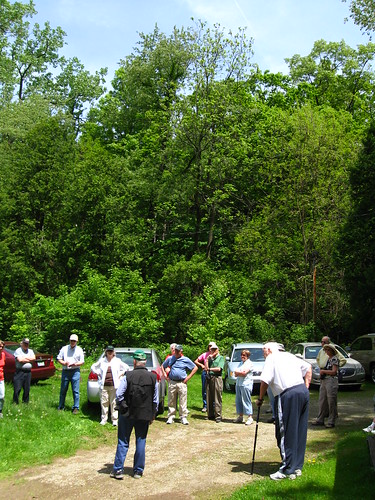
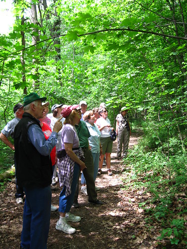
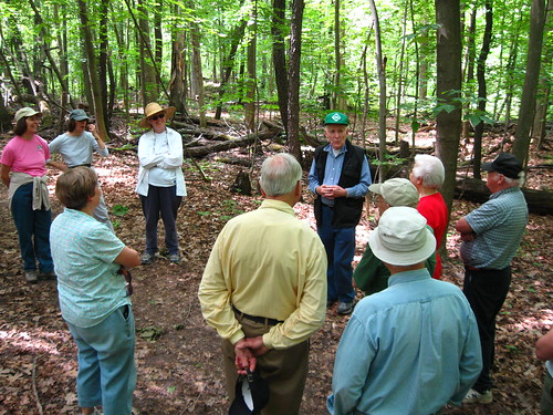
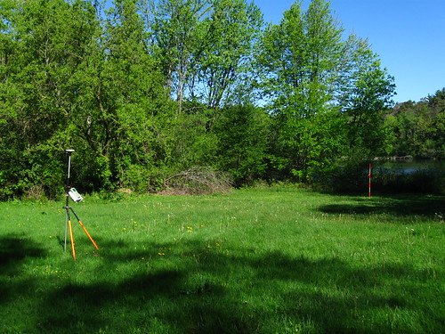
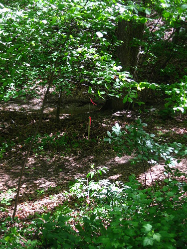
Today, as part of the management plan, there is a surveyor out on the property, making measurements of the toography fifty feet on either side of the creek's center line. If the school can get the data afterwords, this would be an awesome means by which to create a high-definition topography layer for this section of Honey Creek. However, it only stretches 280 feet from the Third Sister Lake, so Prof. Cotel's class wouldn't be able to use it for much of their analysis (i.e., it ends roughly 100 feet downstream of the lowest broken weir). However, it might be useful for looking at the effect of the still-intact weir on flood management.

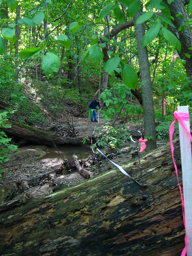
There was a bit of confusion initially with the surveyor when he couldn't find the official benchmark in the region of the cabin. It was listed as being on a nail on the electric pole. However, the electric pole he found didn't have a tagged nail on it. Thus, he went through and started doing his own measurements, picking up GPS satellites and triangulating his position. Only after he went through and walked the course of the stream did we notice the other electric pole, standing right along the old survey transect (which is now completely filled in with trees, and thus camouflaging the wooden pole quite effectively). Sure enough, there was the tagged nail. (Of course, with all the trees grown in around the pole, he can't use the GPS from that point, but at least all measurements will now be tied to the official point.)

I also learned from the surveyor that GPS satellites aren't geosynchronous. I suppose that I should have remembered this from when I took my GIS courses, but it seems to have slipped my mind. Still, I wrote about it on my personal blog, linking to two websites that will (hopefully) help with future timing of GPS activities.

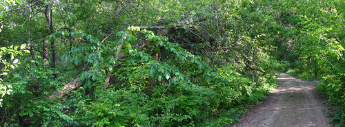
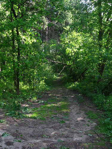
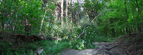
They survey is important for the boardwalk project, because in order to actually get to and from the future boardwalk, it is necessary to cross Honey Creek, and apart from a fallen tree that goes most of the way across (necessitating one to jump the last bit when there's water in the creek), there is currently no bridge or similar structure in place. Of course, due to the erosion of the area, I personally think that some additional measures will need to be put into place to ensure that the large trees in the area -- some of which are having their roots exposed by the flood erosion events -- don't fall on top of the eventual bridge. Although I don't like the idea of creating more of clearing (thus increasing not only the chance of invasive-plant colonization, but also more wind-felled trees), it might have to be done in the area around the bridge. But that will likely be a future consideration.

Monday, May 10, 2010

Felled tree removed

One of the three felled trees has been removed, thanks to the property management people at the University. Thankfully, too, they didn't bring in a wood chipper, which seemed to me to be redundant.

The other other two felled trees will have to be taken care of later, I suppose. The hanging-over-a-road pine possibly with a pole-saw. And the getting-ready-to-fall one whenever it breaks through the small Aesculus that is holding it up.

Sunday, May 9, 2010

Downed trees

The winds on Saturday felled a few trees across and near the road. Normally, I would just cut those trees out, but these trees require more than I am able to do, either because it is in danger of falling further (after some other big wind event) over the road:
Broken Tree 01

about to fall further over the road:
Broken Tree 02

or too big for me to get by myself:
Broken Tree 03

All three are near the bottom of the drive, so I hope that the university's groundskeeping staff will be able to cut them out (and leave the wood behind to break down slowly in the forest).

Sunday, May 2, 2010

Burned the garlic mustard

Today, I spent about 1 hour collecting more garlic mustard from around the property. ... and then (because it was during an interlude between the rains) burned over one wheelbarrow-full of the stuff. The smoke and steam that came off of it was amazing, and I worked hard to burn the rest of the stuff. Luckily, there was enough wood collected from the fall and winter to feed the multiple fist-fulls of garlic mustard.

And then... after about one hour of burning, I scattered the wood, and allowed the ashes the burn down (an oncoming storm front also helped keep the embers down).