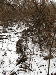
Today I talked with the surveyor on the property. I found him out on the SE corner of Third Sister Lake, surveying the PALL/Saginaw Forest property line. It was an interesting thing to learn about a little bit of the property, and surmise upon the history of certain artifacts in the area. For example, I thought that the location we were standing on was actually inside Saginaw Forest; it was, after all, covered by trees. However, looking around, he pointed out the old fence that was trampled. Using that as the reference point, it became more simple to see where the Saginaw Forest property stops: it's where the tree-type changes from tall pines to not-tall not-pines.
He had placed the prism pole in a steel pole sticking just out of the ground, possibly something that was used in an earlier survey of the lands. He told me there was a similar post in the pavement on Wagner Road, marking the center point of the larger section of land (Saginaw Forest is 80 acres, and is therefore two quarter-quarter sections or an eighth-section) that happens to include First and Second Sister lakes.
Similarly, we talked about the path of Liberty Road in this part of Washtenaw County: where it changes from a city road to a county road. Why does it - before becoming an east-west road - cut through the SE corner of Saginaw forest? He surmised that it was a compromise in planning to connect an east-west road to a non-cardinal road. Looking at a map of the region, it becomes easier to see how the original parcels in the region likely lay, with Liberty Road cutting through the four parcels between Saginaw Forest and I-94 (it takes a little bit of squinting to see where those four parcels used to be).
No comments:
Post a Comment